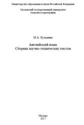
Сборник научно-технических текстов предназначен для обучения чтению технической литературы на английском языке и переводу текстов с английского языка на русский. Пособие составлено с использованием материалов оригинальных неадаптированных текстов энциклопедии Britannica, а также on-line журнала «GEOInformatics» за 2015-2016гг. Дополнено справочной информацией по грамматическим темам и упражнениями для их закрепления, отобранными в соответствии с рабочей программой по дисциплинам «Профессиональный иностранный язык» и «Иностранный язык для специальности». Также приводятся сведения по проблемам теории перевода, рассматриваемым в ходе учебной работы согласно утверждённым программам. Материалы, представленные в пособии, позволяют студентам решить поставленную перед ними задачу по овладению компетенциями, заявленными в рабочей программе курсов.
Пособие снабжено пояснениями к каждому тексту с расшифровкой сокращений, встречающихся в текстах, а также переводом терминологических единиц.
Для студентов-бакалавров и специалистов II и III курсов геодезического факультета, факультета картографии и геоинформатики, факультета прикладной космонавтики и фотограмметрии.
GEODESY.
The scientific objective of geodesy is to determine the size and shape of the Earth. The practical role of geodesy is to provide a network of accurately surveyed points on the Earth's surface, the vertical elevations and geographic positions of which are precisely known and. in turn, may be incorporated in maps. When two geographic coordinates of a control point on the Earth's surface, its latitude and longitude, are known as well as its elevation above sea level, the location of that point is known with accuracy within the limits of error involved in the surveying processes. In mapping large areas, such as a whole state or country, the irregularities in the curvature of the Earth must be considered. A network of precisely surveyed control points provides a skeleton to which other surveys may be tied to provide progressively finer networks of more closely space points. The resulting networks of points have many uses, including anchor points or bench marks for surveys of highways and other civil features. A major use of control points is to provide reference points to which the contour lines and other features of topographic maps are tied. Most topographic maps are made using photogrammetric techniques and aerial photographs.
The Earth's figure is that of a surface called the geoid. which over the Earth is the average sea level at each location: under the continents the geoid is an imaginary continuation of sea level. The geoid is not a uniform spheroid, however, because of the existence of irregularities in the attraction of gravity from place to place on the Earth’s surface. These irregularities of the geoid would bring about serious errors in the surveyed location of control points if astronomical methods, which involve use of the local horizon, were used solely in determining locations. Because of these irregularities, the reference surface used in geodesy is that of a regular mathematical surface, an ellipsoid of revolution that fits the geoid as closely as possible. This reference ellipsoid is below the geoid in some places and above it in the others. Over the oceans, mean sea level defines the geoid surface, but over the land areas the geoid is an imaginary sea-level surface.
Бесплатно скачать электронную книгу в удобном формате, смотреть и читать:
Скачать книгу Английский язык, Сборник научно-технических текстов, Кузьмина М.А., 2017 - fileskachat.com, быстрое и бесплатное скачивание.
Скачать pdf
Ниже можно купить эту книгу, если она есть в продаже, и похожие книги по лучшей цене со скидкой с доставкой по всей России.Купить книги
Скачать - pdf - Яндекс.Диск.
Дата публикации:
Хештеги: #учебник по английскому языку :: #английский язык :: #Кузьмина
Смотрите также учебники, книги и учебные материалы:
Следующие учебники и книги:
 Деловой английский, Пашина А.В., Сперанская Н.И., Яцевич О.Е., 2017 — Учебно-методическое пособие содержит основной учебный материал по английскому языку для магистров очной и заочной форм обучения по направлению Нефтегазовое дело … Книги по английскому языку
 Все предлоги английского языка, Панфилова О.Н., 2013 — Предлагаемое пособие позволит воссоздать и освежить в памяти, полученные в школе знания по английскому языку. Оно направлено на преодоление главных … Книги по английскому языку
 Английский язык, учебно-методическое пособие, Малецкая О.П., Селевина И.М., 2016 — Учебно-методическое пособие предназначено для студентов первого курса медицинского колледжа специальностей Сестринское дело , Лечебное дело , Акушерское дело , Фармация … Книги по английскому языку
 Профессиональный иностранный язык, Английский, часть 1, Лысунец Т.Б., 2017 — Пособие предназначено для студентов 3 курса ИнЭО. изучающих профессиональный курс английского языка по направлениям 18.03.01 Химическая технология , 18.03.02 Энерго- … Книги по английскому языку
Предыдущие статьи:
 English for Masters in Journalism, Костанян З.В., 2018 — Учебное пособие English for Masters in Journalism (Английский для магистрантов-журналистов) представляет собой курс английского языка для студентов магистратуры факультета журналистики … Книги по английскому языку
 Англо-русский глоссарий терминов и понятий в сфере государственного управления и политики, экономики и международной торговли, Килиевич А., 2013 — Этот глоссарий подготовлен в рамках проекта “Региональное сотрудничество и укрепление доверия в Центральной Азии и Афганистане” при поддержке Министерства иностранных … Книги по английскому языку
 Английский язык, полный курс, 2-5 классы, Хацкевич М.А., 2021 — ВВЕДЕНИЕ. Вы держите в руках уникальную книгу для изучения и повторения английского языка во 2 5-м классах. Она охватывает основные … Книги по английскому языку
- Тексты по английскому — Text 7 The World Bank. There arc two parts to the World Bank: the International Bank for Reconstruction and Development … Книги по английскому языку

